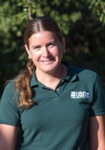
Michelle Sneed is a hydrologist with the U.S. Geological Survey. She spent 25 years leading land subsidence research in the California Water Science Center and now serves as the Technical Support Coordinator for Groundwater Science in the Office of Quality Assurance. She received her BS and MS degrees in geology from California State University, Sacramento, where she subsequently taught geology classes for 10 years. She has published many studies of land subsidence related to fluid-pressure changes in areas throughout California and other areas in the Western U.S., which often had a focus on subsidence impacts to water-conveyance infrastructure. She integrates various methods of land-surface elevation (and elevation change) measurement, including spirit leveling, Global Navigation Satellite System (GNSS), extensometry, and Interferometric Synthetic Aperture Radar (InSAR) techniques, to leverage the diverse spatial and temporal scales of the datasets. Analyses and simulations have focused on the preconsolidation stress, vertical hydraulic conductivities, and the elastic and inelastic compressibilities (storage) of aquifer-system components based on hydrogeological structure, land-surface elevation changes, and groundwater-level changes.
- Herrera-Garcia, G., Ezquerro, P. Tomás, R., Béjar-Pizarro, M., López-Vinielles, J. Rossi, M., Mateos, R.M., Carreón-Freyre, D., Lambert, J., Teatini, P., Cabral-Cano, E., Erkens, G., Galloway, D., Hung, W., Kakar, N., Sneed M., Tosi, L., Wang, H., Ye, S., Mapping the global threat of land subsidence: Science, v. 371, no. 6524, p. 34-36, https://doi.org/10.1126/science.abb8549, 2021.
- Hung, Wei-Chia, Hwang, Cheinway, Sneed, Michelle, Chen, Yi-An, Chu, Chi-Hua, and Shao-Hung Lin, Measuring and interpreting multilayer aquifer-system compactions for a sustainable groundwater-system development, Water Resources Research, 57, https://doi.org/10.1029/2020WR028194, 2021.
- Neely, W.R., Borsa, A.A., Burney, J.A., Levy, M.C., Silverii, F., and Sneed, M., Characterization of groundwater recharge and flow in California’s San Joaquin Valley from InSAR-observed surface deformation: Water Resources Research, 57, https://doi.org/10.1029/2020WR028451, 2021.
- Sneed, M., and Brandt, J.T., Detection and measurement of land subsidence and uplift using Global Positioning System surveys and interferometric synthetic aperture radar, Coachella Valley, California, 2010-17: U.S. Geological Survey Scientific Investigations Report 2020-5093, 74 p., https://doi.org/10.3133/sir20205093, 2020.
- Sneed, Michelle, Brandt, Justin, and Solt, Mike, Land Subsidence Along the California Aqueduct in West-Central San Joaquin Valley, California, 2003–10: U.S. Geological Survey Scientific Investigations Report 2018-5144, 67 p., https://doi.org/10.3133/sir20185144, 2018.


